|
||
|
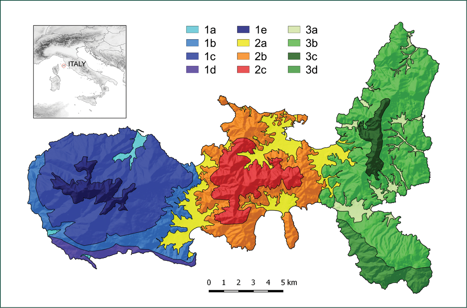
Localisaton of Elba island (red circle) in the Central Mediterranean area and subdivision of the island into 12 Operational Geographic Units. The numbers distinguish the western (1), central (2), and eastern (3) portion of the island, while the letters distinguish ecological belts as follows: (a) alluvial plains, stream banks and shores, (b) hilly areas below 250 m a.s.l., mostly characterised by a mesomediterranean thermotype and a subhumid ombrotype, (c) hilly and mountain areas generally above 250 and below 700 m a.s.l. characterised by mesomediterranean thermotype and humid ombrotype, (d) coastal hilly areas with a thermomediterranean thermotype, and (e) mountain areas above 700 m a.s.l. characterised by mesomediterranean and supramediterranean thermotypes. |